World Water Day 2019: SUSTech researchers investigating clean water for all
World Water Day is an annual United Nations (UN) observance day that highlights the importance of freshwater. It is used to advocate for the sustainable management of freshwater resources around the world. This year’s theme is “Leaving no one behind,” encouraging people to consider marginalized groups as they are often overlooked and discriminated against when they try to access safe water.

Focusing on clean water, sanitation, and hygiene (WASH) falls within the UN’s Sustainable Development Goal 6 (SDG6), which calls for clean water and sanitation for all people. The official wording of SDG6 reads “ensure availability and sustainable management of water and sanitation for all.” Many researchers around the world are working to find ways to improve water quality, testing different methods to improve the accuracy of their data.
As a rapidly rising research university in China, the Southern University of Science and Technology (SUSTech) has been committed to improving water availability and water quality through the School of Environmental Science and Engineering since its inception in 2015. Just last week, SUSTech hosted the International Symposium on Water Security and Climate Change, in conjunction with Chinese Academy of Sciences and Gothenburg University in Sweden, and the conference co-chair, Professor Liu Junguo from SUSTech is a leader in the field.
SUSTech is also home to several key laboratories that are working to stop and reverse water pollution problems. Founding Dean Zheng Chunmiao of the School of Environmental Science and Engineering heads the State Environmental Protection Key Laboratory of Integrated Surface Water- Groundwater Pollution Control. SUSTech is also host to the Guangdong Provincial Key Laboratory of Soil and Groundwater Pollution Control.
The major focus of the School of Environmental Science and Engineering is around water, with the majority of its faculty members examining hydrological matters in some capacity. Whether they are looking at groundwater depletion, watershed biogeochemistry, drinking water safety, waste disposal, or desalination techniques, faculty members and their research team are more often than not tackling some of the world’s biggest water problems.
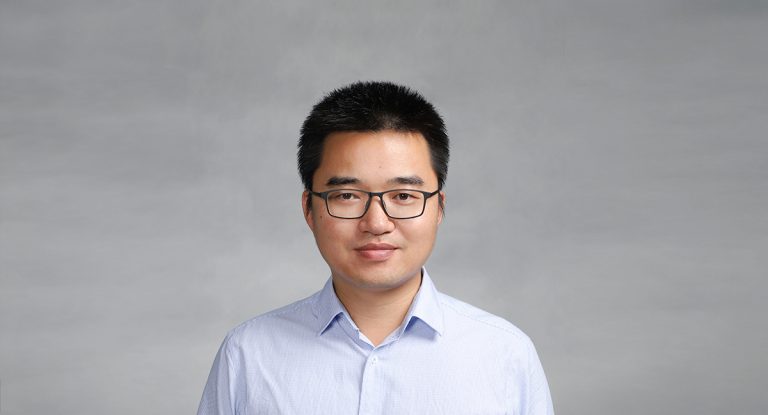
With water quality being an important issue around China and the world for everyone, Assistant Professor Lian Feng is conducting groundbreaking research that could provide far more information about water quality than in the past. His research focus is on the remote sensing of water environments and examining the impact of environmental changes of inland and coastal waters. Lian Feng is also redesigning satellite observations for the improved measurement of changes in the water around the world.

Lian Feng is taking part in a major project in the Guangdong-Hong Kong-Macau Greater Bay Area, where he is hoping to measure the interaction between the mouth of the Pearl River and the South China Sea. The Pearl River is an enormous river system that comes together in the Pearl River Delta, and has become polluted through the rapid development of the region. With the Greater Bay Area hosting nearly 70 million people and a GDP of almost US$1.5 trillion in 2017, it is critical that water quality improves for everyone through this area.
Lian Feng has adapted scientific methodology intended initially for monitoring the ocean surface for studying coastal and inland waters. At first, the oceanic studies would examine plankton reproduction and chlorophyll-a concentration. In more recent years, coastal and inland waters are believed to have been influenced more by humanity. The influences of humans on these areas are important issues for a wide range of academic disciplines.
He uses remote sensing, or satellite data, due to its cost savings and increased quality of the data from satellites. He has published more than 50 papers about remote sensing and the use of satellite data in environmental evaluation. Remote sensing provides a range of data, including electromagnetic waves, infrared radiation and light from the visible spectrum.
Lian Feng uses this data, as opposed to UAVs and submersibles, as a substantial cost saving measure. UAVs do provide a higher resolution than satellite but can only operate to a limited area. On the other hand, the Moderate Resolution Imaging Spectroradiometer (MODIS) that Lian Feng uses can provide images of more than two thousand square kilometers, a substantial improvement on what UAVs offer. The MODIS images are updated every one or two days, with other similar satellites providing full global coverage in just 16 days. Submersibles are also expensive, but Lian Feng is hoping to receive funding for a buoy in the Pearl River Delta that could provide real-time data.
The project on the Greater Bay Area would use remote sensing to monitor the historical changes in water quality between the Pearl River and the South China Sea. He is seeking to link the changes to climate change, human activities or any other outputs. Working with Chair Professor Chunmiao Zheng, the study would look at the correlation between the difference in water quality and the output from the hydrological models. Two surveys have already taken place to calibrate the tests, to ensure that the research team understands what is happening in the water. Lian Feng’s breakthrough has provided critical datasets and important validation methods for advancing the hydrological models of Chunmiao Zheng’s team, resulting in more accurate predictive capabilities.
Lian Feng likens his study to taking a photo. “At first, it’s like taking a photo with a black and white camera. You have to add hydrological models to get some color to the photo. Even if you have a blurry photo, you have some idea about what is happening. With the new models I have worked on with Chunmiao, the images are much sharper, and we can provide a much better analysis of what is happening in the water.”
He reflected on his time in Cambodia with the School of Environmental Science and Engineering. Lian Feng pointed out that Tonle Sap Lake in Cambodia is very similar to Poyang Lake in Jiangxi Province, particularly in terms of their environmental importance. He believed that there is enormous potential to help the people of Cambodia with the knowledge that he gains from his studies both in the Greater Bay Area and more broadly around China and the world.
After this interview, Lian Feng led a team to the middle and lower Yangtze River Basin, starting at the Dongting Lake in northern Hunan Province and heading downstream through central China. He led the group of 10 other scientists to Poyang, Honghu, Futou, Liangzi, Tangxun, Dongting, Sanshan, Shijiu, Changdang, Taihu, Yangcheng, through 11 lakes in total. Satellites allow them to examine the levels of eutrophication and the color of the water, but on the ground, they will be able to get a much better idea of what is happening in each lake. This is the third field trip to these lakes conducted by the group. This research will further support his recent paper that was published in top international journal Remote Sensing of Environment last month, titled “Monitoring and understanding the water transparency changes of fifty large lakes in the Yangtze Plain based on long-term MODIS observations.”
As a well-published young scholar, he has enormous potential to make a huge difference to ensure that governments and policy makers in China and even around the world can make better decisions. Water quality and sanitation for all is of critical importance, and having a better understanding of what specific activities are influencing water quality will provide billions of people the clean water they so desperately need.
--
This article is reprinted from SUSTech News Hub: https://newshub.sustech.edu.cn/?p=12355